Rudolf Kögler`s Commemorative Plaque in Zahrady u Krásné Lípy
Dating: 1899–1949 (plaque unveiled 2006)
Annotation:
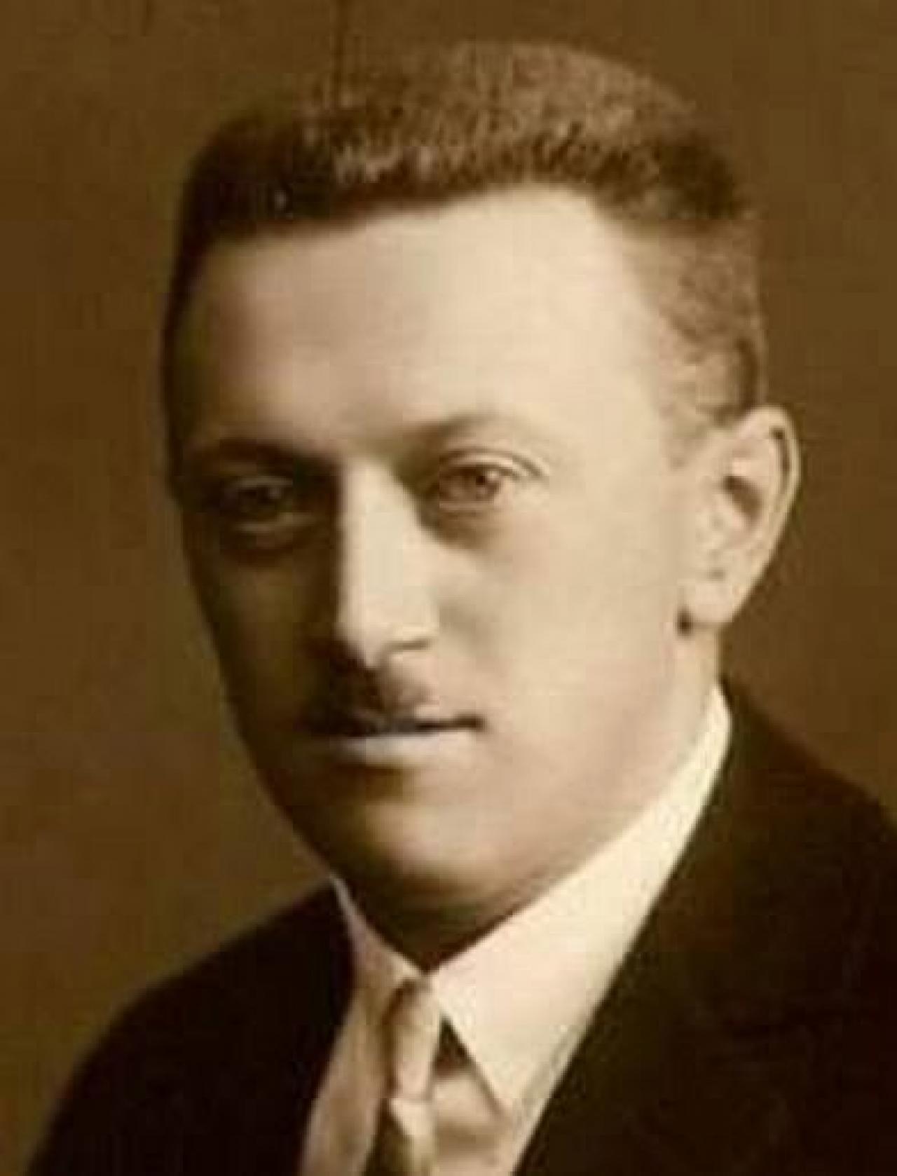
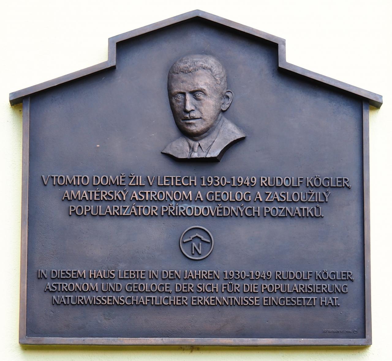
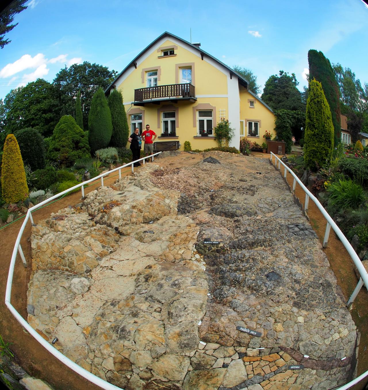
On house no. 30 in Zahrady u Krásné Lípy there is a commemorative plaque to Rudolf Kögler (1899–1949), an amateur geologist and astronomer, who lived here between the years 1930–1949. In the garden of this house Kögler created a unique relief geological map of the local landscape. He is also the author of the first nature trail in the territory of the present-day Czech Republic, which he opened to the public in 1941.
Description:
Kögler was born in 1899 in Krásná Lípa into a poorfamily. Although from his youth he showed a keen interest in nature, his parents could not afford to give him a proper education. He therefore trained as a knitter and worked on various positions in local textile mills. Přírodovědě se nadále věnoval ve svém volném čase jako laik, avšak na vysoké úrovni. He continued to study science as an amateur in his free time, but the level of his erudition was highFrom 1926 he cooperated with the Swiss Federal Observatory in Zurich and provided it with records of his observations. His sketch of the aurora borealis of 25 January 1938 was awarded by the Royal Observatory at Greenwich.
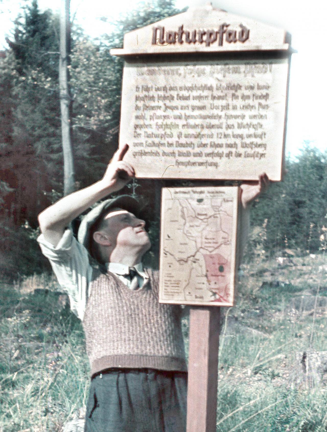
From 1930 Kögler lived in the house of his wife's parents in Zahrady u Krásné Lípy. Here, during the 1930s, he worked on a relief geological map, which he made available to the public in 1937. The map shows the Lusatian Fault running in the vicinity of the Vlčí hora mountain and is made up of authentic rocks collected directly from the respective localities. While working on the map, Kögler had the idea to create an educational hiking trail. He marked out a 12 km long route from Vápenka near Doubice to the Vlčí hora mountain and equipped it with 70 educational boards with information about local geological, botanical and zoological conditions. The trail was opened to the public in 1941 and Kögler was a guide here until the spring of 1945. Although Kögler's family escaped post-war deportation, he himself died tragically at the age of only fifty, due to the failure of the staff at the hospital in Rumburk. While the educational trail decayed and gradually disappeared, the Kögler descendants managed to preserve the geological map in the garden of the house until today.
Real life efforts to restore our oldest nature trail were made only after the establishment of the Czech Switzerland National Park. The trail was officially opened on 13 August 2006, on the same day a commemorative plaque was unveiled on the house in Zahrady. Its author is the Varnsdorf engraver Jiří Trebatický.
Connected places:
Relief geological map in Zahrady near Krásná Lípa
Reliéfní geologická mapa v Zahradách u Krásné Lípy; Köglerova naučná stezka
Keywords: astronomy; geology; mineralogy; Zahrady u Krásné Lípy, Kögler; Geological map
References:
Köglerova naučná stezka byla otevřena, in:
Vikýř, krásnolipský půlměsíčník, 283, 24. srpna 2006, s. 1.
Mrštíková, K.:
Osobnost a dílo Rudolfa Köglera. In:
Mandava 2004. Varnsdorf 2004.
Schol, M.: Zur Erinnerung an Rudolf Kögler... In:
Naturwunder. URL:
http://wincontact32naturwunder.blogspot.com/2014/04/zur-erinnerung-rudolf-kogler.html [2. 8. 2021].
Šafránek, J.: Rudolf Kögler – autor první naučné stezky v Českých zemích,
Ochrana přírody, 4/2018, s. 38–40.
Author's initials: jam
Photos:

Rudolf Kögler (1930s) (Author: public domain)

Rudolf Kögler installs a board on his nature trail. (Author: Archive of the Schnittner family)

Detail of the memorial plaque. (Author: AH)

Kögler created a relief geological map in the garden of his house. (Author: AH)


