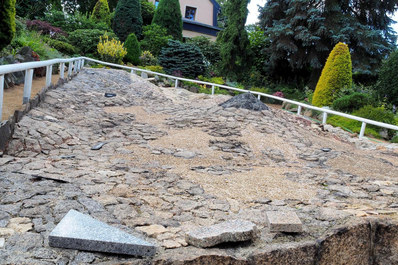
Relief geological map in Zahrady near Krásná Lípa
Dating: 1931–1935, 1937
Annotation:
Situated on private land by house no. 30 in Zahrady near Krásná Lípa there is a unique relief geological map. It is a model of the local landscape made from authentic material – rocks collected at the sites displayed on the map. It was created in the 1930s by the amateur geologist Rudolf Kögler. The map has been listed as one of the cultural monuments of the Czech Republic since 1958.
Description:
Rudolf Kögler (1899-1949), a textile designer and amateur natural scientist, built the relief map in the garden of his home between 1931 and 1935. Spread across an area of 50 m2 it shows part of the Šluknov Spur between Staré Křečany, Brtníky, Doubice and Vápenka, i.e. an area covering a total of 29 km2. The map uses different scales for the lengths (1:760) and the heights (1:380); this means that the formations on the map are shown as being twice as high as they really area.
Dominant landmarks featured on the map include Vlčí hora, and specially the course of the Lusatian Fault. This is a tectonic line that separates the granite complex (Lusatian Intrusion) from the territory formed by sedimentary rocks (Elbe sandstone). Kögler also traced the Lusatian Fault in a nature trail that he, with the help of friends and the Mountain Association for the Northernmost Bohemia, built in 1941 between Vápenka and Vlčí hora (it is now part of the new Kögler Nature Trail through the Krásnolipsko Region).
In 1937 Kögler opened his work to the public. Thanks to the care taken by his descendants the relief map is kept in good condition and can be visited during the summer season. It is also worth seeing examples of the slickenside rocks (smoothed, mirror-like surfaces formed by the movement and friction of rocks at the tectonic interface of lithospheric plates and fault joints) that can be found around Vlčí hora. These are part of the Alpine garden (rockery) surrounding the map.
Connected places:
Rudolf Kögler`s Commemorative Plaque in Zahrady u Krásné Lípy
Pamětní deska Rudolfa Köglera v Zahradách u Krásné Lípy; Köglerova naučná stezka
Keywords: geology; cartography; geological map; Lusatian Fault; Rudolf Kögler; Krásná Lípa
References:
Coubal, M.; Adamovič, J.; Šťastný, M.:
Lužický zlom: hranice mezi dvěma světy. Praha 2018.
Kühn, J.:
Lužické hory. Města a obce: Zahrady. URL: http://www.luzicke-hory.cz/mista/index.php?pg=obzahdc [19. 4. 2021].
Památkový katalog: Reliéfní geologická mapa. URL:
https://pamatkovykatalog.cz/reliefni-geologicka-mapa-12345905 [19. 4. 2021].
Author's initials: jam
Photos:

The map shows an area of 29 km2. Notice the basalt peak of Vlčí hora. (Author: AH)

Dominant landmarks featured on the map is the course of the Lusatian Fault, a tectonic line that separates the granite complex (Lusatian Intrusion) from the territory formed by sedimentary rocks (Elbe sandstone). (Author: AH)


